แสงดาว นพพิทักษ์
Profile: Scopus, research gate, google scholar
Thesis
- Deep Learning for Land Use and Land Cover in Aerial Images
- การเรียนรู้เชิงลึกสำหรับการใช้ประโยชน์ที่ดินและสิ่งปกคลุมดินในภาพถ่ายดาวเทียม
Publications
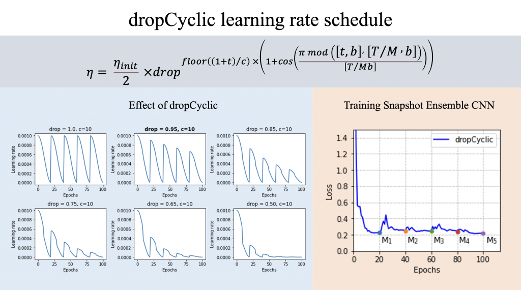
- Noppitak, S. and Surinta, O. (2022). dropCyclic: Snapshot Ensemble Convolutional Neural Network Based on a New Learning Rate Schedule for Land Use Classification, IEEE Access, 10, 60725-60737. (ISI Q2, Impact factor 3.367)

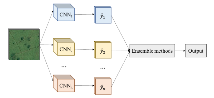
- S. Noppitak and O. Surinta (2021). Ensemble Convolutional Network Architectures for Land Use Classification in Economic Crops Aerial Images. ICIC Express Letters, 15(6), 531-543. (Scopus Q3)

- S. Noppitak, S. Gonwirat, and O. Surinta (2020). Instance Segmentation of Water Body from Aerial Image using Mask Region-based Convolutional Neural Network, in Information Science and System (ICISS), The 3rd International Conference on, 61-66. slide, video, https://doi.org/10.1145/3388176.3388184


